20th Century Birmingham
by Space_Play
A guide to the creation of this Birmingham-inspired artwork from the makers

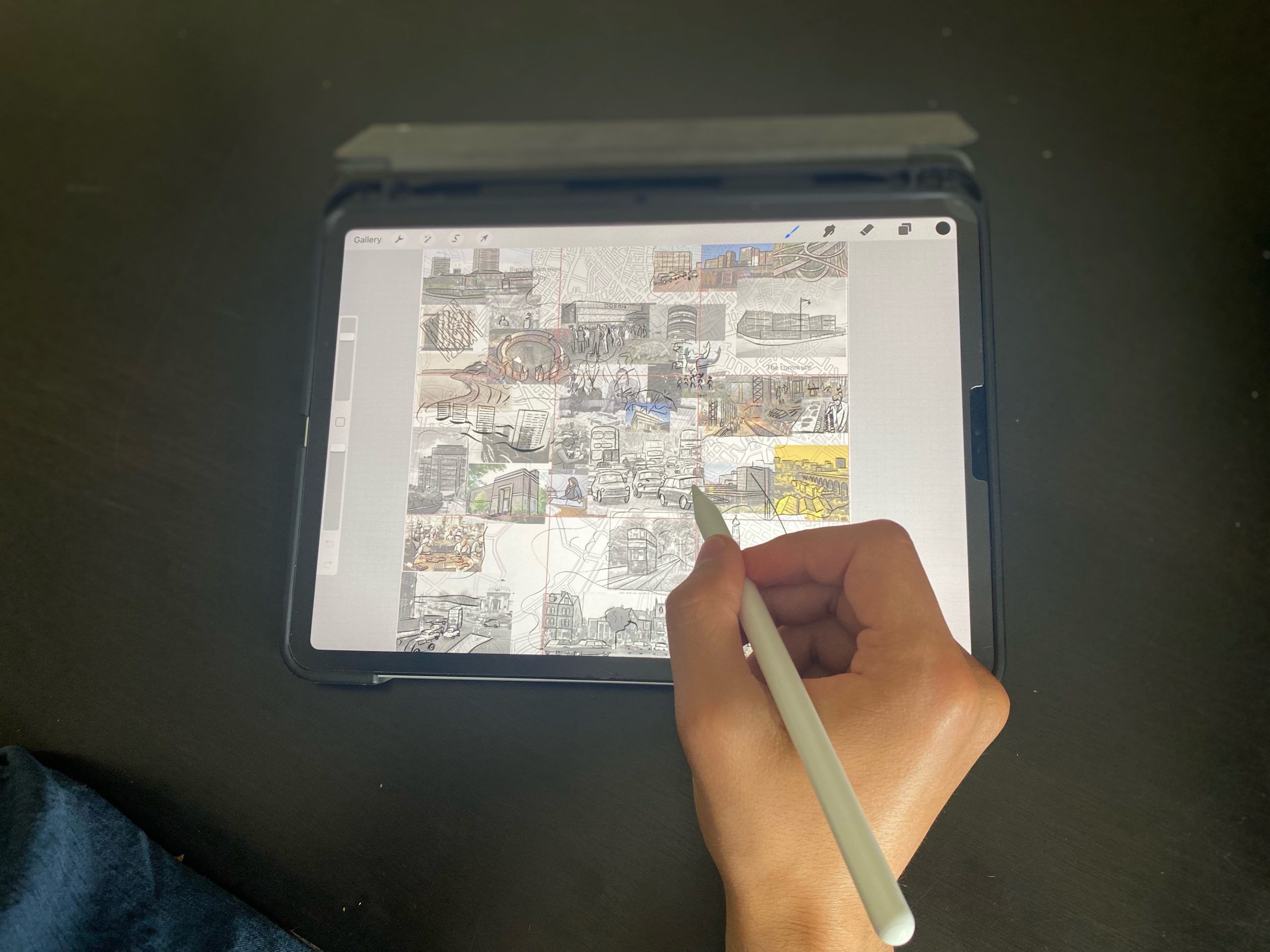
Our Initial Thoughts
Our 20th century map tells the story of Birmingham’s expansion into a truly international city. We were fascinated by the complete reinvention that the city experienced after the Second World War. Who was behind this new direction? What would the new city have looked like? How did it impact ordinary people’s lives?
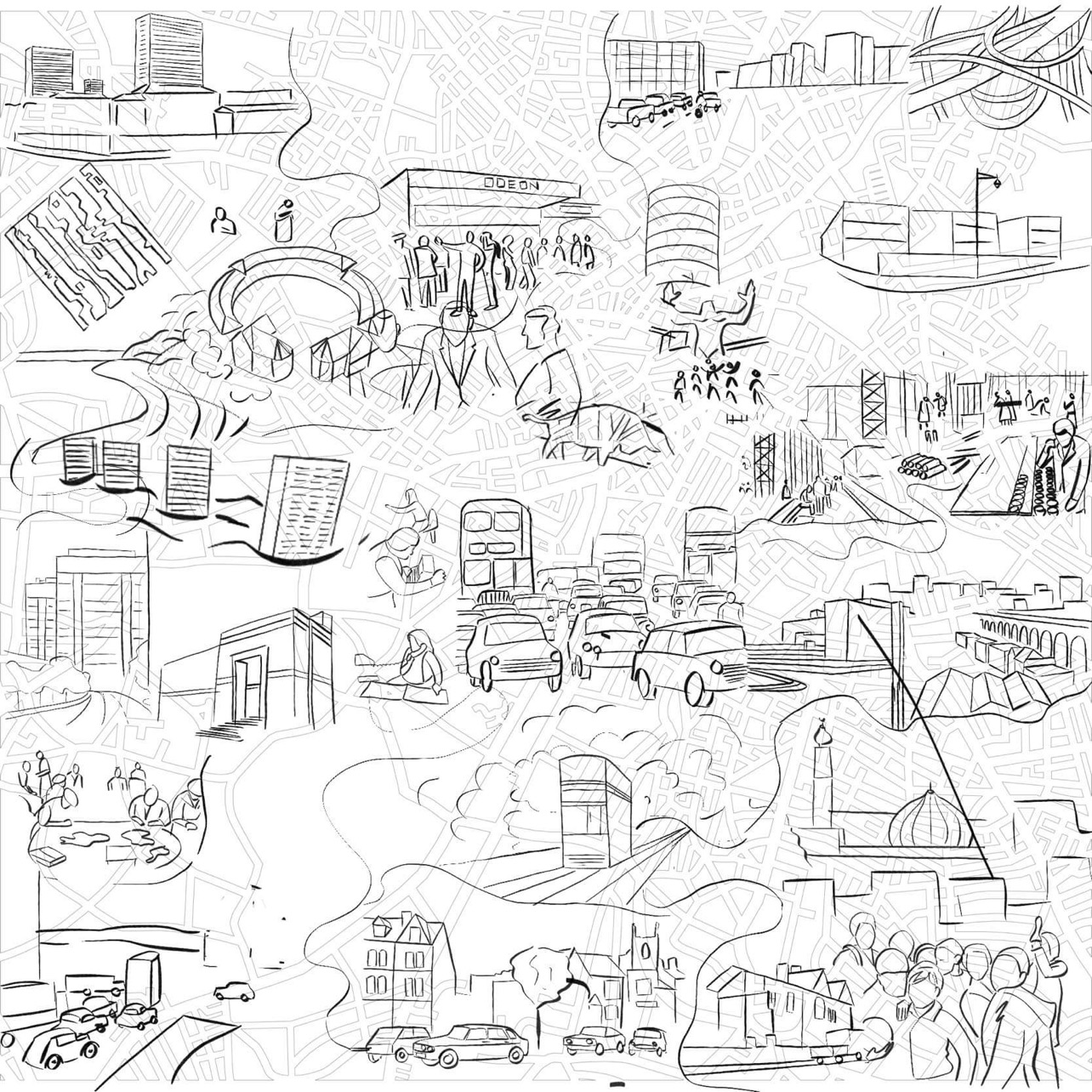
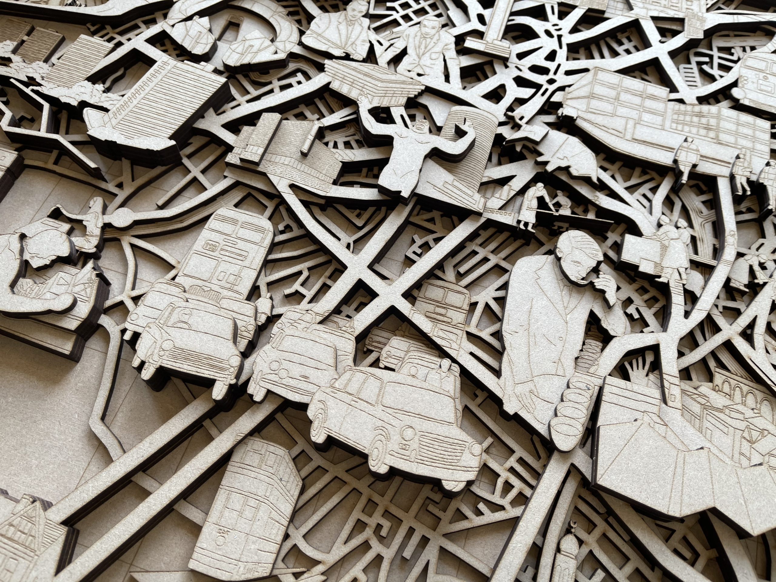
Architects John Madin and Herbert Manzoni were particularly notable in planning post-war Birmingham and they were behind many of the buildings you can see in this map including the Rotunda, Central Library, BT Tower and the Bullring Shopping Centre. That said, we wanted this map to reflect the many individuals whose names are not in the history books but have nonetheless had a profound effect on the city’s development.
We were hugely inspired by the women workers at the famous Cadbury Factory, white-collar workers on the commute and the migrants who brought so much to Birmingham during this era.
In the 20th Century, Birmingham was the city of the car. In fact, it is difficult to overestimate the impact that the advent of motor vehicles had on the city. Intricate road network, traffic jams, music blaring from car windows; Birmingham had changed so much since the Victorian Era when horsepower was supreme.
The Roundhouse underwent a variety of changes during this era, going from stables to a council depot and then to the host of a range of small businesses. But the building itself stood constant as the urban landscape around it transformed and we wanted to highlight the survival of this unique Victorian building in the context of radical urban redevelopment.
Creating and Producing the Design
A key challenge when selecting imagery and detail was to imagine how landmark architecture such as the Odeon cinema, the 1960s Bullring and Birmingham Library, and the Spaghetti Junction would have looked like when they were first built.
Some of these buildings have been demolished while others are still around and part of Birmingham’s architectural heritage. We wanted to portray these buildings as they were on opening day to evoke the feelings of excitement and intrigue which they undoubtedly would have been met with.
Making a collage of photography from the time was helpful in bringing out the details of 20th century era. When looking at the collage as a whole, it was angular shapes, the concrete tones and crowded streets which came to the fore.
Electrification of the railway lines brought fast-moving public transport, and the new ring road system for cars reshaped the city. Our maps emphasise these new transport networks whilst the canal system is pushed back as an old forgotten network during this era. That said, we were also concerned with the individuals at the heart of 20th century Birmingham. Zooming in on a tea taster at the Typhoo factory, office workers and children playing football provided a glimpse into the personalities who lived and worked in this sprawling concrete jungle.


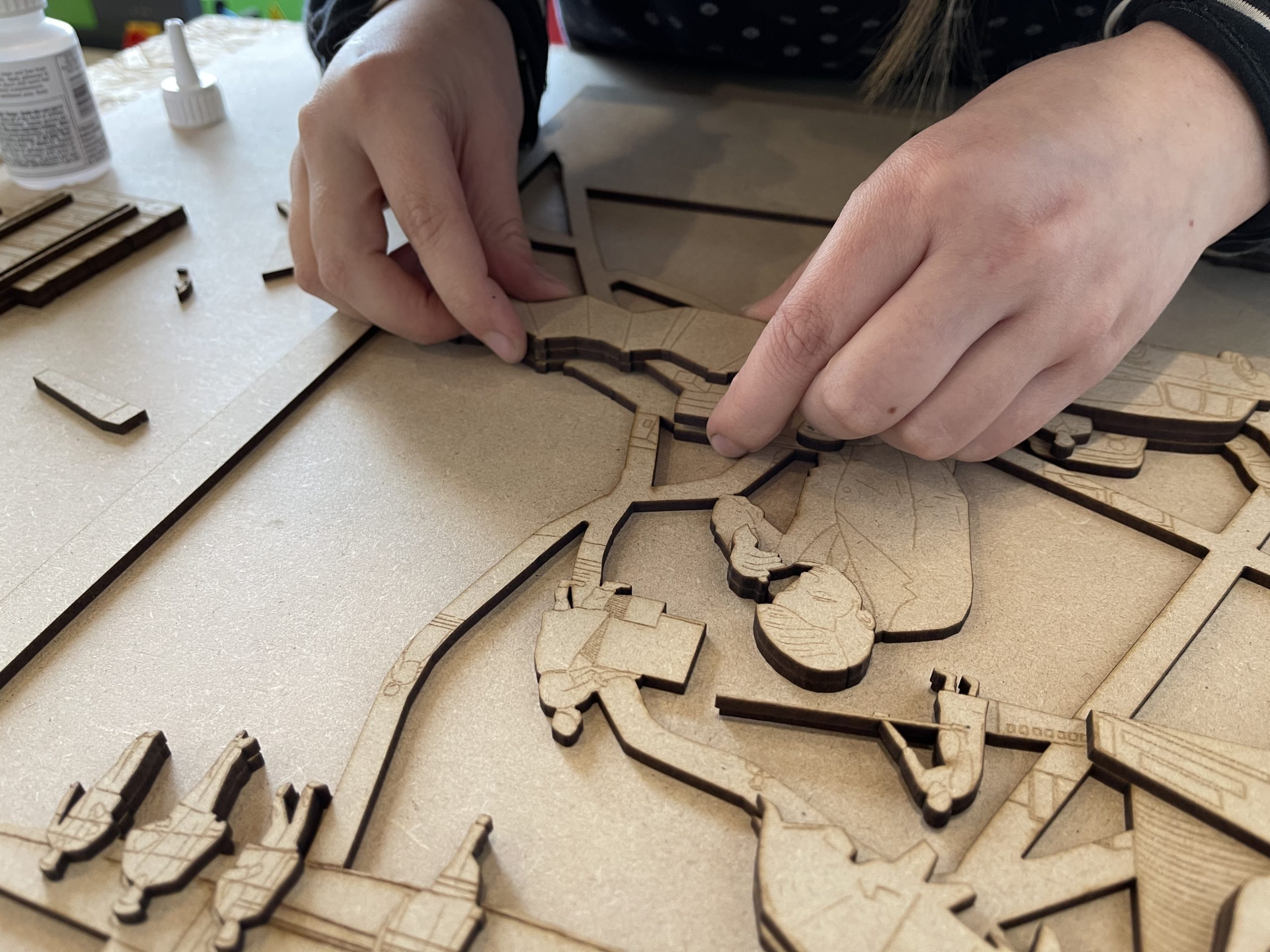
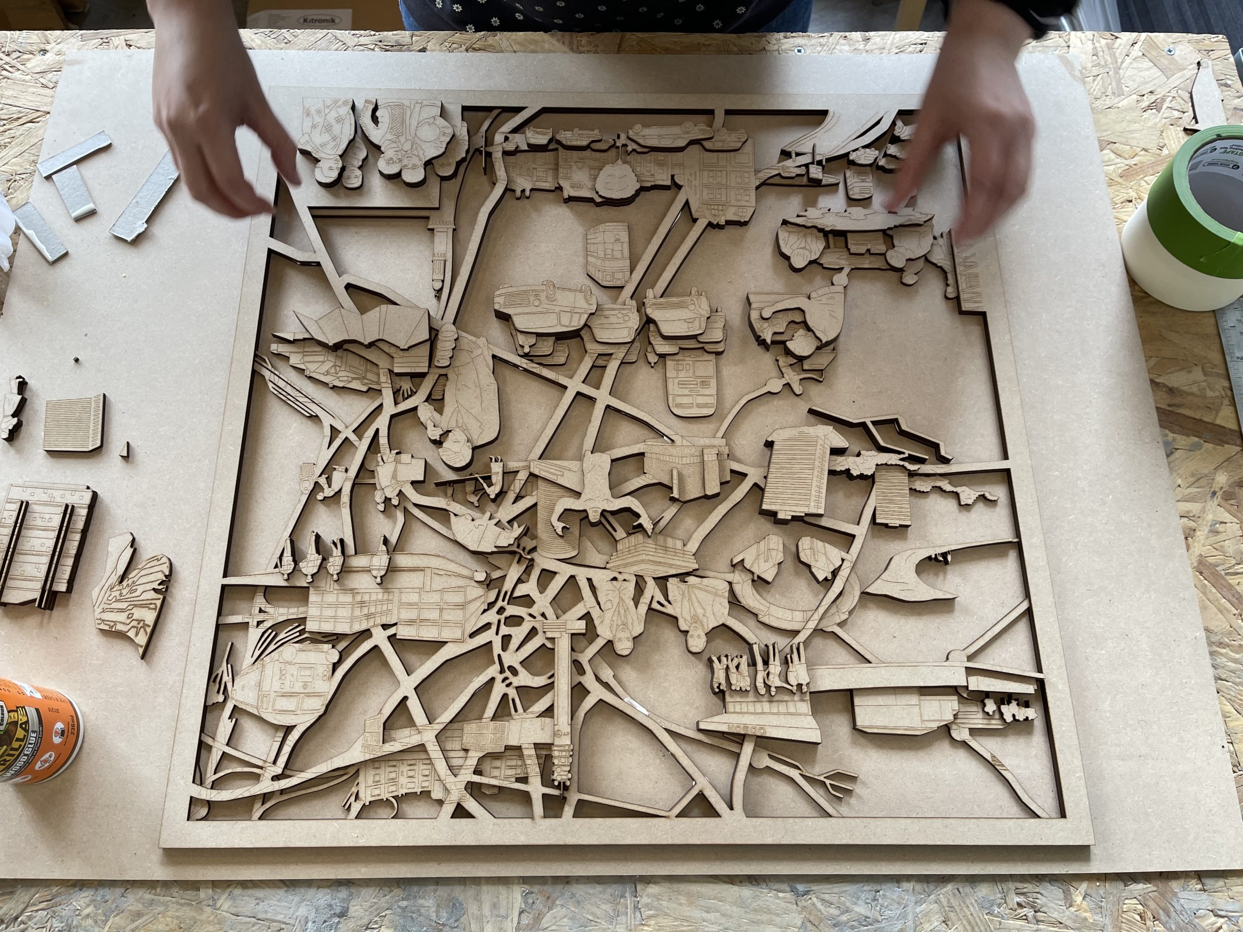
Moulding and Casting
Once the mastermould was fixed together and had dried it was used to create a casting mould. We used silicone rubber to create this mould by pouring a liquid mixture over the wooden map. The silicone sets as a firm rubber and after several hours can then be peeled away from the mastermould creating a perfect imprint of it.
The final map was then cast using concrete Jesmonite. We chose this material as it best reflected the material used to build many of the 20th century urban landmarks portrayed in this map.
A total of 6kg of Jesmonite was mixed by hand and cast into the silicone mould. After 24 hours the mould was peeled away leaving a solid cast relief of the artwork we had designed.


